
The Nazca Lines are often treated as one of the ancient world’s strangest puzzles.
That is understandable.
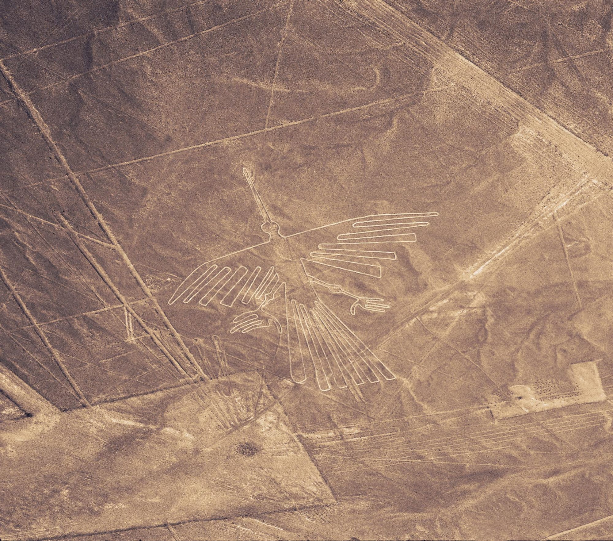
Across the dry coastal plain of southern Peru, enormous lines, trapezoids, spirals, animals, plants, human-like figures, and abstract forms stretch across the desert floor. Some are best seen from above. Some can be recognized from nearby hills. Some seem to move with the land itself, crossing open pampas, ridges, paths, and ceremonial landscapes.
The common question is simple:
Why did ancient people make drawings so large they could barely see them from the ground?
But that question may already be too narrow.
The Nazca Lines are not only images.
They are a landscape system.
They are ritual geometry.
They are cultural memory laid onto the earth.
They are evidence that ancient societies were capable of organizing scale, movement, symbol, and sacred geography without needing modern machinery, metal tools, aircraft, or written explanations carved beside the work.
That is where the real mystery begins.
Not with aliens.
Not with runways.
Not with an ancient airport.
The deeper mystery is why a culture would turn the desert itself into a symbolic field, and what kind of reality they believed they were entering when they walked, marked, aligned, and maintained those lines.
The Nazca Lines matter because they challenge a modern assumption:
That meaning has to be readable from our point of view to be intelligent.
But ancient landscapes were not always built for tourists, pilots, satellites, or modern observers.
Sometimes they were built for gods.
Sometimes for ancestors.
Sometimes for ritual movement.
Sometimes for social memory.
Sometimes for the sky.
Sometimes for the community walking the line, not the outsider looking down.
The Nazca Lines are not a message we have fully decoded.
They are a reminder that the ancient world did not only build monuments upward.
Sometimes it wrote meaning flat against the earth.
Overview
The Nazca Lines are a vast collection of ancient geoglyphs spread across the desert plains of southern Peru, particularly around Nazca, Palpa, and the Nazca Pampa.
A geoglyph is a large design created directly on the ground. At Nazca, ancient communities generally made them by removing the darker, weathered surface stones and exposing the lighter earth beneath.
The result was a landscape filled with:
- long straight lines
- trapezoids and triangles
- spirals and radiating networks
- animals and plants
- human and human-like figures
- imaginary or composite beings
- tracks and path-like forms
The best-known figures include the hummingbird, monkey, spider, condor, whale, dog, tree, and hands. But these famous images represent only one part of a much larger system dominated by geometric lines, cleared areas, pathways, and overlapping designs.
The geoglyph tradition developed across multiple cultural periods. UNESCO places the principal phases between approximately 500 BC and AD 500, while archaeological research around Nazca and Palpa traces early examples to the Paracas period and continued development through the Nasca cultural sequence.
“Nasca” is common in formal archaeological and UNESCO usage. “Nazca” remains the more familiar spelling in English.
The lines were not one artwork created at one moment.
They accumulated across centuries.
Different designs may have served different audiences and purposes. Some enormous figures and geometric systems appear connected to community-level ritual activity. Many smaller figures discovered more recently are positioned close to ancient trails, where they could have been viewed by individuals or small groups on the ground.
That distinction changes the central question.
The mystery is not how ancient people created large designs without aircraft. The basic construction method is understood, and organized communities could enlarge designs using measurement, stakes, ropes, sightlines, and coordinated labor.
The deeper mystery is what the different geoglyphs did within the societies that created them.
Were they ritual pathways?
Images connected to water, fertility, and sacred geography?
Markers along traveled routes?
Community gathering spaces?
Astronomical alignments?
Stories embedded in the land?
The evidence increasingly suggests that Nazca was not one message waiting for one solution.
It was a landscape used to communicate at multiple scales.
Origins and Background
The Nazca Lines did not appear suddenly, and they were not created by a single unknown population outside established history.
They belong to a long geoglyph tradition developed by ancient societies of Peru’s southern coast.
Research from the Nazca-Palpa archaeological project places some of the earliest geoglyphs in the Paracas period, approximately 800 to 200 BC. The tradition reached its fullest development during the early and middle Nasca periods, particularly from around the beginning of the Common Era through approximately AD 450.
Geoglyph production appears to have declined and ended by roughly AD 600.
That chronology matters because it reveals development rather than interruption.
Earlier Paracas geoglyphs frequently appeared on hillsides, where they could be seen from the surrounding landscape. Later Nasca communities expanded the practice across flatter desert plains, producing larger figures, extensive line systems, trapezoids, and ceremonial spaces.
The desert made their survival possible.
Dark stones exposed to the environment developed a weathered surface. By moving those stones aside, the makers revealed lighter soil underneath. In most environments, wind, vegetation, rain, construction, or erosion would eventually erase such shallow markings.
The extreme aridity of the region allowed many of them to survive.
The desert became an archive.
Modern archaeological attention developed gradually. Peruvian archaeologist Toribio Mejía Xesspe studied the geoglyphs from the ground during the early twentieth century. Paul Kosok later examined the lines from the air and proposed that some had astronomical importance.
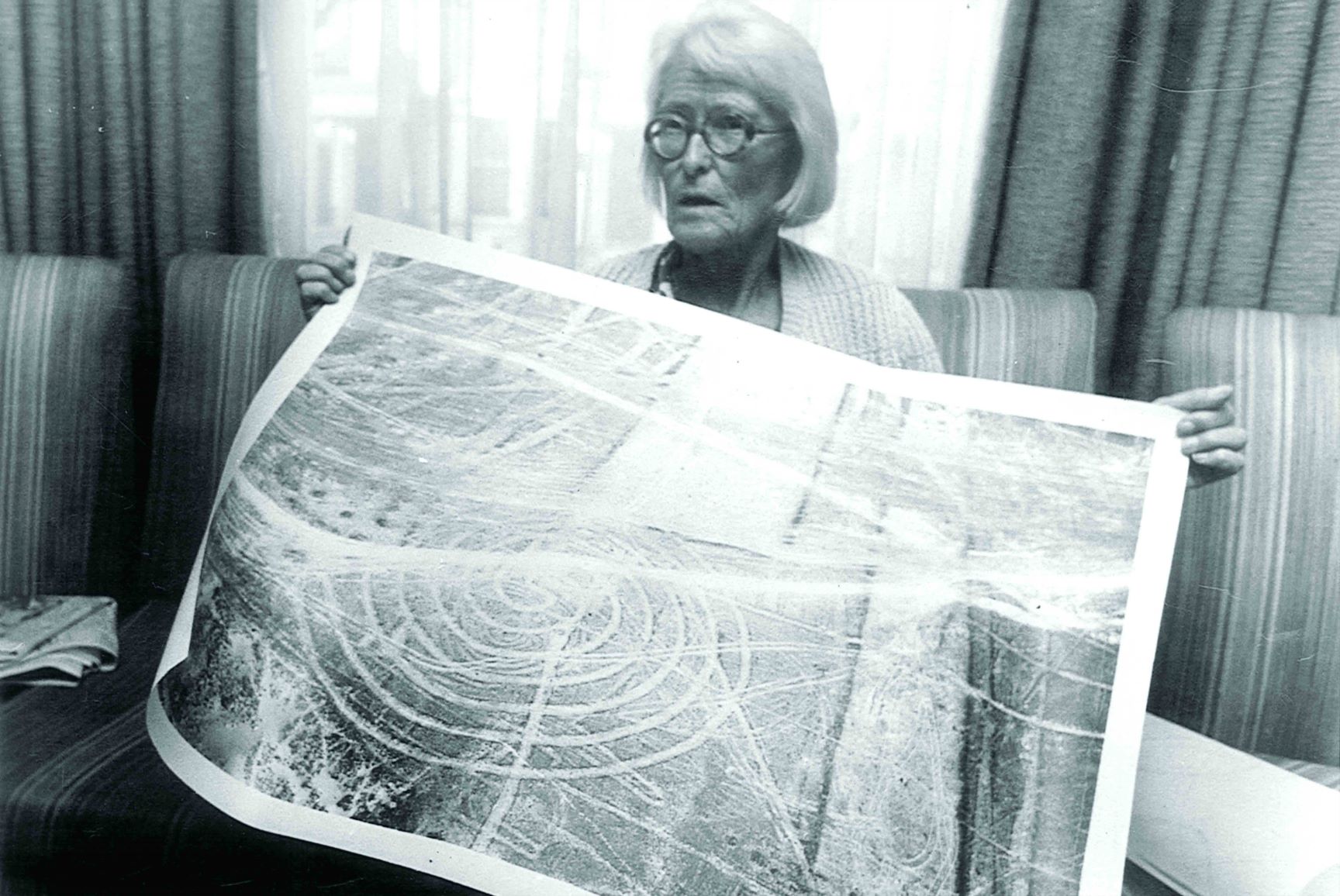
María Reiche then devoted decades to mapping, studying, publicizing, and protecting the landscape. Her work helped make Nazca internationally recognizable and strengthened the idea that the lines formed an astronomical calendar.
Later research complicated that interpretation.
Some alignments may relate to celestial or horizon events, but statistical and archaeological studies have not supported the idea that the entire landscape functioned as one unified astronomical system.
This pattern continues throughout Nazca research.
The more completely the landscape is mapped, the less likely it appears that one theory explains everything.
Nazca is better understood as a cultural system that changed across time—a landscape where ritual, movement, water, social memory, symbolism, and observation may have overlapped without becoming separate categories.
What It’s Known For
The Nazca Lines are known for their scale, precision, preservation, and mystery.
They are also known for the way they provoke interpretation.
The desert becomes a mirror.
People look at the lines and often see the worldview they already carry.
The scientist sees survey planning.
The archaeologist sees ritual landscape.
The astronomer sees horizon alignments.
The hydrologist sees water anxiety.
The mystic sees sacred geometry.
The ancient astronaut theorist sees landing strips.
The artist sees the world’s largest drawing surface.
The historian sees a civilization organizing meaning at landscape scale.
The truth may not be any one of these alone.
Monumental geoglyphs
The most immediate feature is the size.
Some figures are tens or hundreds of meters long. Some geometric lines continue for kilometers across the desert.
This scale is what makes the lines feel impossible at first.
But the construction method itself was not impossible.
A community with stakes, ropes, sightlines, repeated labor, memory, and planning could create large, controlled shapes on the ground.
The mystery is not whether they could do it.
They could.
The mystery is why they chose to do it at this scale, in this landscape, for this long.
Animal and symbolic figures
The famous figures are not random doodles.
They connect to broader Andean symbolic worlds, where animals, water, fertility, mountains, sky, and supernatural forces were deeply intertwined.
Birds matter.
Monkeys matter.
Whales matter.
Spiders matter.
Serpents, felines, fish, and other beings appear in Andean art and ritual contexts across time.
Many of these forms likely carried cultural meanings that are not fully recoverable today.
The modern viewer sees a hummingbird.
The Nazca maker may have seen motion, water, fertility, ritual power, journey, transformation, or a relationship between human communities and nonhuman forces.
The image may not have been “art” in the modern sense.
It may have been an action.
A mark that did something.
Geometric networks
The geometric lines may be even more important than the animals.
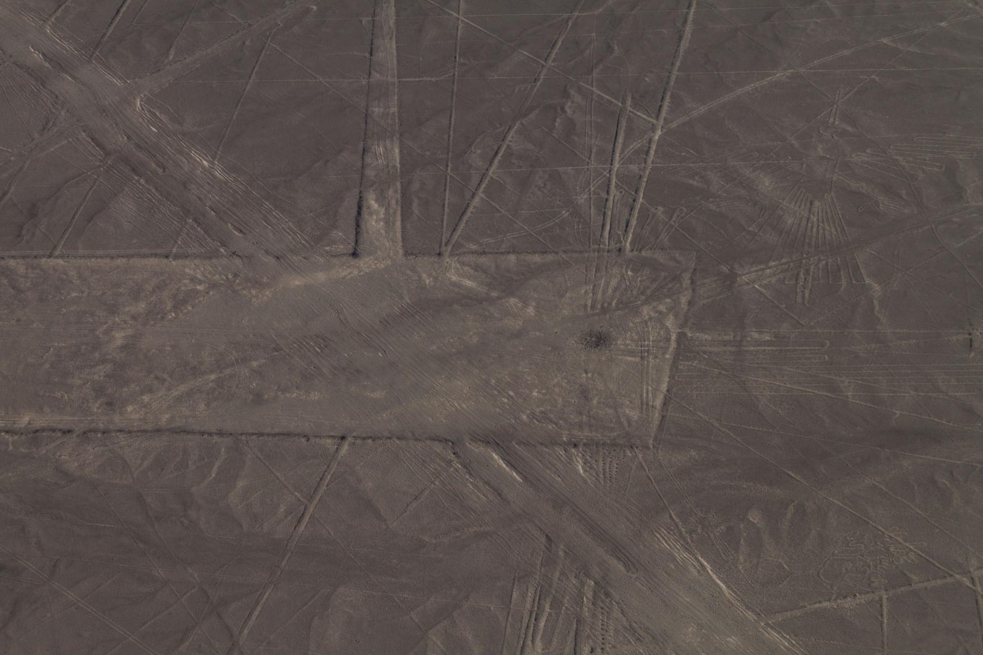
Straight lines, trapezoids, and path-like forms cover large parts of the desert. Some connect to hills, ridges, platforms, or pathways. Some appear to guide movement through the landscape.
This has led many researchers to interpret at least some lines as processional routes.
In other words, the lines may not have been made only to be looked at.
They may have been made to be walked.
That changes everything.
A line seen from above is an image.
A line walked from the ground is a ritual path.
One is visual.
The other is embodied.
The ancient meaning may have lived in the act of movement, not the aerial view.
Water, fertility, and sacred landscape
The Nazca region is dry.
That simple fact may be one of the keys.
In a desert society, water is not just a resource.
It is survival.
It is sacred.
It is social power.
It is seasonal anxiety.
It is the difference between continuity and collapse.
Some researchers have connected the lines to water rituals, mountain worship, fertility concerns, and ceremonial movement across the landscape.
This does not mean every line points to water.
But it does mean the lines should be read inside a world where water, mountains, sky, and ritual were not separate categories.
The desert was not empty.
It was alive with relationships.
Ongoing discoveries
The Nazca archive is still expanding.
In 2024, researchers from Yamagata University and IBM Research published the results of an AI-accelerated survey that identified 303 previously undocumented figurative geoglyphs during six months of fieldwork.
The artificial-intelligence system did not independently “discover” or interpret the geoglyphs.
It analyzed aerial imagery and identified promising locations for archaeologists to investigate. Researchers then examined and documented the candidates in the field.
That distinction matters.
AI accelerated the search.
Archaeological confirmation established the discoveries.
The results also revealed a meaningful difference between two broad categories.
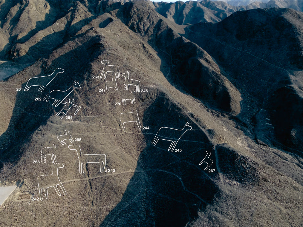
Smaller relief-type geoglyphs primarily depicted humans, domesticated animals, decapitated heads, and other human-associated subjects. They were typically positioned within viewing distance of winding ancient trails—an average of approximately 43 meters away in the 2024 study.
Researchers proposed that these figures may have communicated information to individuals or small groups moving through the landscape.
The larger line-type figures more frequently depicted wild animals. They were associated with the extensive networks of lines and trapezoids and may have functioned in community-level ceremonies.
Then, in July 2025, researchers announced another 248 geoglyphs identified through AI-supported surveys conducted during 2023 and 2024. Of these, 160 were described as figurative, raising the reported total of known figurative geoglyphs to 893.
The new figures included humans, birds, llamas, geometric designs, and scenes associated with ritual activity. Their arrangement along ancient paths strengthened the possibility that groups of geoglyphs carried narratives, social memories, or sacred information rather than functioning only as isolated artworks.
These discoveries do not mean AI has decoded Nazca.
They mean the available map has changed.
The landscape now appears even more layered:
Large communal designs associated with formal geometric networks.
Smaller figures encountered while moving along trails.
Images operating at different scales.
Different audiences.
Possibly different purposes.
The mystery is not simply growing in quantity.
It is becoming more structured.
The Core Idea or Signal
The core signal of the Nazca Lines is this:
Ancient people did not only build objects. They built relationships between land, sky, movement, memory, and the unseen.
That is the deeper frame.
The Nazca Lines are often misunderstood because modern people try to turn them into a single message.
A code.
A calendar.
A runway.
A map.
A signal.
A puzzle with one solution.
But the ancient world did not always divide reality that way.
A line could be art, path, offering, alignment, social boundary, ritual technology, memory device, and sacred act at the same time.
A figure could be a symbol and a being.
A path could be walked by people and addressed to forces beyond people.
A desert could be an empty landscape to outsiders and a living ceremonial field to those who knew how to read it.
This is why the lines matter.
They ask us to reconsider what intelligence looks like when it is embedded in landscape rather than machines.
The Nazca Lines are not strange because ancient people were primitive and somehow did something advanced.
They are strange because they reveal a different kind of sophistication.
Not industrial.
Not digital.
Not mechanical.
Ceremonial.
Spatial.
Communal.
Cosmological.
The lines are a form of reality architecture.
They organize the human body, the desert surface, the horizon, the sky, and the sacred into a single field of action.
That is the signal.
Not “ancient aliens built runways.” Even though that is a fun thought experiment.
But something subtler:
A civilization turned the desert into an interface.

Perspectives and Interpretations
The Nazca Lines have been interpreted through many lenses.
Some are grounded.
Some are speculative.
Some reveal more about modern imagination than ancient intention.
The archaeological view
The strongest archaeological view sees the Nazca Lines as a ritual and cultural landscape created by ancient societies of the Peruvian south coast.
This view places the lines inside known Andean traditions involving sacred geography, pilgrimage, water, mountains, ceremony, and social organization.
The lines were not made by a technologically impossible people.
They were made by organized human communities with environmental knowledge, ritual systems, and the ability to mobilize labor across generations.
This is the grounded center.
The lines are extraordinary.
But they are not outside human capability.
The astronomical view
The astronomical interpretation has a long history.
Paul Kosok and María Reiche helped popularize the idea that the lines may have functioned as a calendar or celestial map. Some lines may align with solar events, horizons, or astronomical directions.
The sky almost certainly mattered in Nazca life.
Ancient societies across the world observed solar cycles, lunar cycles, stars, seasons, and horizon events because these shaped agriculture, ritual timing, navigation, and cosmology.
But the hard question is whether the Nazca Lines as a whole form a coherent astronomical system.
Later analysis challenged the idea of a universal astronomical calendar. Some alignments may be meaningful. Many may be coincidental. When a landscape contains thousands of lines, some will point toward significant celestial events by chance.
The careful position is this:
Astronomy may be part of the system.
It is probably not the whole system.
The water and fertility view
The water interpretation remains one of the most compelling.
The Nazca region is arid. Any culture living there would have been deeply concerned with rainfall, runoff, rivers, springs, aquifers, and seasonal change.
Some researchers have connected the lines to mountain deities, water sources, fertility rituals, and processional movement intended to engage forces that sustained life.
This interpretation feels grounded because it fits the ecology.
A desert people marking the land in relation to water and sacred power is not strange.
It is deeply human.
But again, the caution remains:
Not every line has to mean the same thing.
The landscape may have accumulated meanings over centuries.
The ground-level and processional view
One of the strongest modern corrections to the popular Nazca story is that not every geoglyph required an observer in the sky.
The 2024 AI-assisted research found that many smaller relief-type figures were located close to ancient trails and could have been viewed from the ground. Their subjects frequently involved people, domesticated animals, human activity, and ritual imagery.
These may have functioned as signs, narrative markers, territorial memories, or symbolic encounters experienced while traveling.
The larger line-type figures followed a different pattern. They were positioned near the formal networks of straight lines and trapezoids and may have been associated with community-level ceremonies.
This suggests at least two scales of experience.
The intimate scale:
A person or small group walking a trail and encountering an image.
The communal scale:
Larger gatherings moving through or assembling around geometric spaces and monumental figures.
Movement may therefore have been part of the meaning.
The lines were not necessarily completed only by being seen.
Some may have been completed by being walked.
A procession turns distance into ritual.
Repetition turns a route into memory.
The body becomes part of the design.
This does not prove that every line was a ceremonial path or that every figure belonged to the same ritual system. But it weakens one of the most persistent modern assumptions:
That the Nazca Lines must have been created for aerial viewers because modern audiences understand them most easily from the air.
The view from above reveals their form.
The view from the ground may have carried their function.
The ancient astronaut view
The most famous fringe interpretation is that the lines were made for beings from the sky.
Landing strips.
Aerial signals.
Messages to visitors.
Markers for craft.
This interpretation became popular because the lines are visually dramatic from the air.
It also fits a modern technological imagination.
We see a large desert marking and ask:
Who was above it?
But the evidence does not support the ancient runway theory.
The lines are shallow surface clearings. They are not engineered landing infrastructure. They match known cultural, artistic, and ritual traditions in the region far better than aerospace speculation.
Still, the ancient astronaut interpretation reveals something important.
It shows how strongly the Nazca Lines activate the question of the viewer.
Who were they for?
Humans on the ground?
Gods in the sky?
Ancestors?
Mountains?
Ritual participants?
Future generations?
Aerial beings?
Modern satellites?
The ancient astronaut answer is weak as archaeology.
But the question behind it remains powerful.
Strengths and Limitations
The Nazca Lines have an unusually strong evidentiary foundation for an ancient mystery.
The geoglyphs physically exist.
Their construction method can be observed.
Their relationship to Paracas and Nasca cultural history is documented.
Their distribution can be mapped.
Associated trails, settlements, ceramics, ceremonial locations, and environmental features provide archaeological context.
Modern surveys can also compare different geoglyph types, subjects, locations, and periods.
A grounded ledger separates what this evidence can and cannot establish.
What is documented:
Ancient societies of Peru’s southern coast created thousands of geometric and representational ground markings across a long cultural sequence.
They produced the designs primarily by moving darker surface stones aside and revealing lighter ground.
The geoglyphs were created at different times, overlap in places, and include multiple forms rather than one uniform system.
What is strongly supported:
The geoglyphs were human constructions connected to the ritual, social, environmental, and symbolic life of Paracas and Nasca communities.
Different categories likely served different functions. Some smaller figures were positioned for people traveling along trails, while larger designs appear connected to communal line and trapezoid networks.
What remains debated:
The degree to which individual lines related to water, astronomy, pilgrimage, fertility, political organization, sacred geography, storytelling, or ceremonial movement.
Some of these interpretations may apply to certain geoglyphs without explaining the entire landscape.
What is not established:
There is no archaeological evidence that the lines functioned as landing strips, required aircraft to construct, were created by extraterrestrial visitors, or encoded advanced non-human technology.
The surfaces are shallow clearings, not engineered runways.
What remains unavailable:
The makers left no single written explanation that identifies the meaning of every figure or geometric system.
The landscape developed over centuries, and meanings may have changed as later communities reused, crossed, renewed, or reinterpreted older designs.
The strongest conclusion is therefore layered rather than singular.
Nazca is not mysterious because nothing is known.
It remains mysterious because a large body of evidence points toward several overlapping functions rather than one final answer.
Broader Implications
The Nazca Lines matter because they change how we think about communication.
Modern people often assume communication is text, speech, code, signal, or digital transmission.
But ancient communication could be spatial.
It could be walked.
It could be seen from a hill.
It could be performed by a community.
It could be addressed to beings not visible in ordinary life.
It could be embedded into land so deeply that the landscape became the message.
That is the broader implication.
Nazca forces us to expand what we mean by intelligence.
A society does not need machines to think at scale.
It does not need satellites to design across terrain.
It does not need writing to preserve symbolic systems.
It does not need modern maps to understand orientation, direction, repetition, and movement.
The lines reveal a civilization capable of coordinating perception across different scales:
The scale of the footstep.
The scale of the procession.
The scale of the hilltop.
The scale of the horizon.
The scale of the sky.
The scale of memory.
That is why they remain powerful.
They sit between art and infrastructure.
Between ritual and geometry.
Between the human and the more-than-human.
Between what is visible and what is meant.
They also matter because they remind us how fragile interpretation is.
When a culture disappears without leaving a full explanation, later observers inherit the object but not the worldview.
We can measure the lines.
Map them.
Photograph them.
Model them.
Date them.
Discover new ones with AI.
But meaning is not always preserved with structure.
A line can survive while its prayer disappears.
That may be the central tragedy of Nazca.
The desert kept the marks.
History lost the voice.

The Reality Signal
What this subject represents
The Nazca Lines represent the ancient human impulse to make reality relational.
They are not simply drawings.
They are a system of marks connecting people to land, sky, water, ritual, memory, and unseen forces.
They represent a worldview in which the ground was not passive matter.
It was a surface of communication.
A place where human communities could address the cosmos by altering the earth itself.
The Nazca Lines are a reminder that ancient people did not always separate art, religion, astronomy, ecology, and social order.
They fused them.
What reality frame it challenges
The Nazca Lines challenge the modern assumption that intelligence must look technological in a contemporary sense.
They also challenge the belief that large-scale coordination requires modern tools.
The lines were made with simple techniques, but that does not make them simple.
Their sophistication is not in the machinery.
It is in the planning, symbolism, persistence, and cultural meaning.
They also challenge the modern obsession with aerial vision.
Because the lines are famous from above, many assume they were made for aerial viewers.
But that may be our bias.
We live in an age of planes, drones, satellites, and map apps.
We are trained to think from above.
The Nazca makers may have been thinking through walking, ritual, horizon, and sacred presence instead.
The view from above may reveal the form.
It may not reveal the function.
Why it matters now
Nazca matters now because two different futures are converging over the same desert.
The first is technological.
Satellites, drones, high-resolution aerial photography, geospatial modeling, lidar, and artificial intelligence are allowing researchers to identify patterns too faint or numerous for conventional surveys to process efficiently.
The 303 figurative geoglyphs reported in 2024 were followed by another 248 geoglyphs announced in 2025. The reported number of known figurative designs has now reached 893, and researchers expect additional discoveries as remaining AI-generated candidates are investigated.
The sky is finally helping humanity read the ground.
But the second future concerns preservation.
The geoglyphs are shallow and physically vulnerable. Vehicles, roads, mining, urban expansion, flooding, tourism, and deliberate disturbance can damage in minutes what the desert preserved for centuries.
In 2025, Peru briefly reduced the boundaries of the wider protected archaeological reserve around Nazca by approximately 42 percent. The decision generated concern about informal mining and threats to undocumented archaeological material.
After national and international criticism, the government reversed the measure and restored the wider protected area. The controversy concerned the surrounding archaeological reserve rather than removing the core UNESCO property from the World Heritage List, but it revealed how vulnerable the larger landscape remains.
This creates a difficult tension.
New technology is showing that more geoglyphs may exist beyond the most famous protected figures.
At the same time, economic and environmental pressures continue moving across the same territory.
Discovery therefore creates responsibility.
Every new figure expands the archive.
It also expands what could be lost.
What remains unresolved
The unresolved ledger begins by separating the landscape from the stories placed upon it.
What is established:
The Nazca and Palpa geoglyphs were created by ancient societies of Peru’s southern coast through deliberate alteration of the desert surface.
They include figurative images, geometric forms, straight lines, trapezoids, radiating networks, and path-like structures produced across multiple cultural phases.
What is strongly supported:
The landscape carried ritual, social, and symbolic importance.
Recent spatial analysis supports a distinction between smaller relief-type figures associated with trails and larger line-type figures connected to communal geometric networks.
What remains debated:
The precise functions of individual geoglyphs.
Some may have served as ritual pathways.
Some may have related to water, fertility, mountains, or sacred geography.
Some may have carried astronomical meaning.
Some smaller figures may have communicated stories, warnings, identities, or memories to people walking nearby.
What remains speculative:
Claims involving extraterrestrial construction, ancient landing strips, advanced energy grids, global machine systems, or codes intended for aircraft or non-human observers.
No physical evidence currently establishes those interpretations.
What remains unknowable for now:
How the makers themselves named the lines.
What emotions accompanied their construction.
Which beings, forces, communities, or ancestors they believed were present.
Whether the figures were primarily images, pathways, offerings, boundaries, narratives—or several of these at once.
Why it still matters:
Because Nazca demonstrates that ancient communication did not need to be written in books.
Meaning could be placed into movement.
Geometry.
Landscape.
Memory.
A civilization could turn the desert into an interface without leaving us the instructions for how it was meant to be read.

The Galactic Mind Perspective
The Nazca Lines belong in The Galactic Mind archive because they reveal how easily the past becomes strange when its worldview is missing.
The grounded explanation is already extraordinary.
Ancient communities transformed a desert into a symbolic landscape across generations.
They organized geometry across vast spaces.
They embedded animals, lines, paths, and ritual forms into one of the driest regions on Earth.
They created marks that could survive for nearly two thousand years.
That is enough.
We do not need to inflate Nazca into alien runways to make it meaningful.
But we also should not flatten it into “just ritual” and move on.
The word ritual can become a place where modern people hide what they do not understand.
Ritual is not a weak explanation.
Ritual is technology of meaning.
It coordinates people, time, place, memory, fear, desire, ecology, and the unseen.
In a desert, ritual may be survival logic expressed through sacred action.
The deeper question is not whether every speculative claim about Nazca is true.
The deeper question is why the lines still feel like a message.
Maybe they were.
Not a message to aliens.
Not a message to aircraft.
Not a message to us in the modern sense.
But a message across the relationship between human beings and the forces they believed sustained the world.
The Nazca Lines ask us to remember that some civilizations did not write their deepest questions in books.
They wrote them into the land.
A Dossier is not a monument.
It is a map of influence.
And the influence of Nazca is clear:
It expands the meaning of intelligence beyond machines, beyond text, beyond cities, and into the sacred geometry of landscape itself.
Open Thread
The Nazca Lines leave behind a question that does not resolve cleanly.
Who was meant to see them?
The gods?
The mountains?
The dead?
The living?
The community walking the paths?
The sky itself?
Or us, centuries later, arriving with aircraft, cameras, satellites, drones, and AI?
Maybe the strangest possibility is not that the Nazca Lines were made for beings from the sky.
Maybe it is that they were made from a worldview where the sky, land, water, and human body were already part of one living system.
In that world, a line in the desert was not just a mark.
It was a relationship.
And maybe that is what modern people keep missing.
We look for the code.
They may have been walking the connection.
What do you think? Drop your thoughts in the comments ...
More in Dossiers
Puma Punku and the Precision Problem of Ancient Stone
The shattered architecture of Puma Punku tests the boundary between genuine ancient engineering, lost construction knowledge, and modern claims of impossible technology.
Sacsayhuamán and the Stone Intelligence of the Inca World
Above Cusco, monumental fitted stones reveal how Inca engineering, ritual, political authority, and sacred landscape became one architectural system.
The Nebra Sky Disc and the Bronze Age Map of Heaven
A portable Bronze Age cosmos that may have combined celestial observation, seasonal knowledge, ritual meaning, and social authority in a single object.
Sources / Receipts
- UNESCO World Heritage Centre — Lines and Geoglyphs of Nasca and Palpa
Official World Heritage description covering the site’s location, chronology, construction, cultural significance, scale, preservation, and protected status. - German Archaeological Institute — Archaeological Project Nasca-Palpa
Archaeological chronology connecting early geoglyph production to the Paracas period and its fullest development to the early and middle Nasca periods. - University of Zurich — Analysis and Interpretation of the Nasca Lines at Palpa
Research project documenting more than 1,500 geoglyphs through fieldwork, photogrammetry, archaeological context, and three-dimensional modeling. - PNAS — AI-Accelerated Nazca Survey
Peer-reviewed 2024 study reporting 303 new figurative geoglyphs and distinguishing smaller trail-associated relief figures from larger community-level line figures. - Yamagata University — AI-Accelerated Nazca Survey Research Summary
University explanation of the research methods, AI candidate selection, field confirmation, motif distribution, and proposed relationships between geoglyphs and ancient trails. - Nasca Geoglyphs Preservation and Research Association
Research and preservation updates connected to Yamagata University, including the 2025 announcement of 248 additional geoglyphs and the reported figurative total of 893. - Yale eHRAF Archaeology — “Order in the Nazca Lines”
Summary of Anthony Aveni’s field research addressing movement, water-related ritual, overlapping construction phases, and the limitations of a universal astronomical interpretation. - Reuters — Peru Restores Nazca Lines Protection After Mining Controversy
Reporting on Peru’s 2025 decision to reduce—and subsequently restore—the wider protected archaeological reserve surrounding the Nazca landscape.


Discussion