
Overview: Who This Is
Editorial note: Public photographs of Louis de Cordier can be found online, but we were unable to verify permission or a suitable publication license for their reuse. To respect the rights of the photographer and subject, no portrait has been reproduced in this Dossier.
Louis de Cordier is a Belgian artist and independent investigator whose name has become closely associated with the modern search for the Egyptian Labyrinth at Hawara. He is not an Egyptologist or geophysicist. His consequential role was different: he developed the concept, raised private support, and coordinated the international framework that became known as the 2008 Mataha Expedition, while specialists from Egypt’s National Research Institute of Astronomy and Geophysics conducted the scientific fieldwork.
The object of that search is not invented. South of the mud-brick pyramid of the Middle Kingdom ruler Amenemhat III lies the damaged footprint of an enormous cult complex. A University of Leeds project describes it as approximately 120 by 300 metres and identifies it as the likely basis of the building that Herodotus later called a labyrinth. Nineteenth- and early-twentieth-century excavation established that a monumental structure had stood there. What has not been established is that a vast, intact, multi-level complex still survives beneath the site.
That distinction is the center of this Dossier. De Cordier helped bring modern geophysical attention to a legitimate archaeological problem. The resulting measurements produced intriguing subsurface patterns, and later research has found additional anomalies that may represent cavities or archaeological remains. Yet instruments measure contrasts in the ground; they do not, by themselves, identify rooms, inscriptions, archives, or the precise building described in an ancient text.
De Cordier belongs in The Galactic Mind archive because his story exposes a productive tension at the edge of investigation. Outsider curiosity can mobilize people, money, and technology around a neglected question. It can also outrun the evidence it helped produce. Hawara asks us to preserve both sides of that truth.

Origins and Background
The story begins nearly four thousand years ago, not in 2008. Amenemhat III ruled during Egypt’s Twelfth Dynasty, approximately 1855–1808 BCE. At Hawara, on the southeastern side of the Faiyum, he built a pyramid with a mud-brick core and an adjacent mortuary or cult complex. The complex remained a place of royal worship for many centuries, but its stone was later quarried and reused. By the modern period, the pyramid had eroded into a low mound and the temple had been reduced largely to foundation beds, fragments, and a vast field of limestone chips.
Herodotus visited Egypt in the fifth century BCE, more than a millennium after Amenemhat III. In Histories 2.148, he wrote that the labyrinth surpassed even the pyramids in labor and cost. He described twelve roofed courts and three thousand chambers divided equally between upper and underground levels. One qualification is essential: Herodotus said he personally saw the upper rooms, but the underground chambers were described to him by Egyptian custodians who would not admit him. His celebrated lower labyrinth was therefore reported testimony, not an eyewitness observation.
Strabo, writing centuries later, also described a great palace-like complex near Lake Moeris and the pyramid of its royal builder. The classical accounts preserve evidence that an unusually large and complicated monument remained culturally visible long after its construction. They do not provide a consistent architectural survey. The authors wrote at different times, attributed the building to different rulers or political purposes, and encountered a structure already altered by centuries of use and dismantling.
Modern investigation arrived in stages:
- In 1843, Karl Richard Lepsius excavated brick structures at Hawara and identified them with the labyrinth, although Flinders Petrie later argued that these were later buildings erected over the destroyed complex.
- In 1888–1889, Petrie traced an enormous bed of compacted sand, limestone chips, pavement, architectural fragments, and inscriptions south of the pyramid. He concluded that the monumental building had been comprehensively quarried.
- In 1911, Petrie returned with Guy Brunton Wainwright and Ernest Mackay. Their 1912 publication attempted a partial reconstruction while acknowledging how little of the plan could be recovered securely.
- In 2008, the geophysical work promoted as the Mataha Expedition returned the question to the subsurface using non-invasive instruments rather than broad excavation.
De Cordier entered this history from art rather than archaeology. Gallery records identify him as a Belgian artist born in Ostend in 1978 and describe him as self-taught. His own expedition publication presents the search as an “art and science” undertaking: he organized lectures, brought collaborators together, and says he financed the project through sales of a sculptural timepiece called the Golden Sun Disk. That description comes from the project’s own promotional record, so it establishes how the expedition represented itself, not independent verification of every institutional or financial detail.
The division of labor matters. The 2010 Mataha booklet names de Cordier as coordinator and concept originator, while naming NRIAG geophysicist Abbas Mohamed Abbas as director of the Hawara survey. Ghent University’s involvement was described through Kunst-Zicht, an art and communication initiative. “Mataha Expedition” was therefore the public identity of a hybrid project, not evidence that de Cordier personally performed or authored the geophysical analysis.

What He Is Known For
Reopening a question Petrie considered nearly closed
Petrie accepted Hawara as the location of the famous labyrinth, but he believed its stone architecture had been almost entirely removed. He found an immense construction bed—roughly one thousand by eight hundred feet in his estimate—along with surviving pavement and decorated fragments. The loss was so complete that he doubted the building’s plan could ever be recovered with confidence.
De Cordier’s central proposition reversed the direction of the search. What if the surface that Petrie treated as a foundation or destruction layer concealed deeper architecture? The question was testable in principle. Instead of beginning with excavation, a survey could look for electrical or electromagnetic contrasts consistent with walls, voids, shafts, or disturbed ground.
That was a worthwhile intervention. It did not require accepting Herodotus literally, and it did not require assuming that Petrie was careless. It asked whether a nineteenth-century conclusion, reached from the surface and limited trenches, could be examined with instruments unavailable to Petrie.
The 2008 Hawara survey
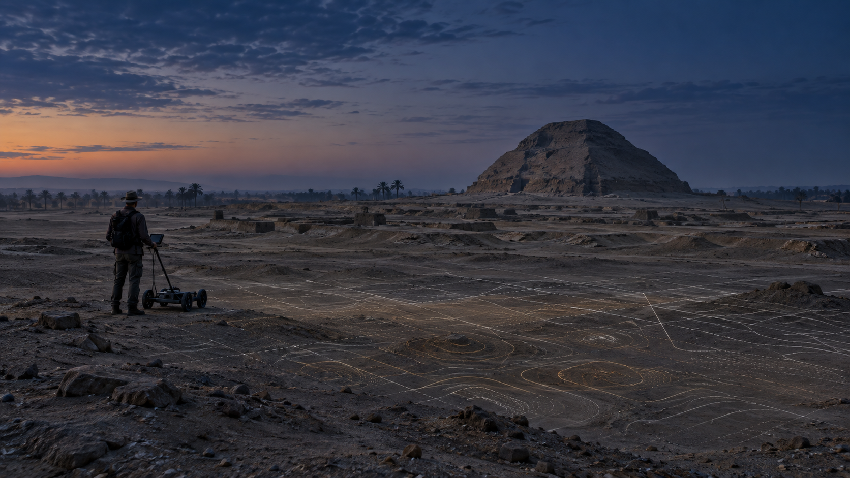
The expedition’s own materials describe fieldwork conducted between February and March 2008 with authorization from Egypt’s Supreme Council of Antiquities. They portray de Cordier as the organizer and private funder and NRIAG researchers as the scientific team. In later retellings, several methods are sometimes grouped under the loose language of “radar” or “scanning.” The strongest published scientific record from that research period is more specific.
In 2010, Mohamed Ahmed Khalil, Abbas Mohamed Abbas, Fernando A. Monteiro Santos, Hany S. A. Mesbah, and Usama Massoud published a peer-reviewed study in Near Surface Geophysics. Using very-low-frequency electromagnetic measurements on a closely spaced grid, supported by nine vertical electrical soundings, they calculated two- and three-dimensional resistivity models. The study reported elongated and square anomalies at shallow depths, connected in some places and separated in others, whose distribution the authors believed significantly matched Herodotus’s account.
This is substantial evidence that the ground south of the pyramid contains organized physical contrasts worthy of further investigation. It is not the same as excavation. Resistivity and electromagnetic data are interpreted models shaped by soil, moisture, geology, rubble, instrument design, line placement, filtering, and inversion choices. They can indicate where archaeological features may exist without revealing exactly what those features are.
The difference becomes especially important because the peer-reviewed paper does not use the Mataha branding in its title or list de Cordier as an author. His role was catalytic and organizational; the scientific claims belong to the named geophysicists and must be read in the calibrated language of their publication.
The claim of a surviving underground labyrinth
De Cordier has interpreted the survey more strongly. His publications argue that the results confirmed a large grid of walls and chambers beneath the surface and support the possibility that Petrie exposed a roof rather than the lowest foundation of the complex. He has also alleged that Egyptian authorities restricted discussion or continuation of the work, a claim revived in a 2026 podcast appearance framed around his reported exile.
Those statements are part of de Cordier’s documented public position. They are not independently established by the sources reviewed for this Dossier. The 2008 project booklet itself acknowledged that water affected the consistency of the data, that only limited areas of a much larger puzzle had been surveyed, and that the total size and shape of the presumed structure could not be concluded. It recommended renewed work after dewatering.
The careful formulation is therefore neither “nothing was found” nor “the labyrinth was discovered.” The surveys found anomalies. Researchers proposed archaeological interpretations. The identity, date, form, and preservation of the targets remain unverified without ground-truthing.
The return of geophysics and conservation
Hawara did not disappear from institutional research after 2008. From 2018 to 2022, an Arts and Humanities Research Council project led by Nottingham Trent University, with the University of Leeds, Egypt’s antiquities authorities, and NRIAG, combined archaeological records, laser scanning, geophysics, environmental monitoring, and virtual reconstruction. Its public record emphasizes documentation and conservation as much as discovery, particularly the severe threat posed by groundwater.
A 2024 paper by Mona Fathy Elshazly and colleagues added new electrical resistivity tomography and transient electromagnetic results based on fieldwork conducted in 2019 and 2021. Twenty-five ERT profiles were run in accessible areas around the pyramid and across the labyrinth zone. Several high-resistivity anomalies south of the pyramid could indicate open cavities, shafts, halls, rooms, or other archaeological remains. Examples included features roughly four to six metres wide at depths of about five to 7.5 metres.
The authors did not identify those anomalies as the lost labyrinth. Their conclusion says the targets may represent archaeological remains and require verification through standard excavation. At the same time, low-resistivity zones mapped water intrusion from the north, northeast, and cultivated land to the east. The site’s urgent reality may therefore be less cinematic than a sealed archive but more immediate: whatever survives beneath Hawara is being investigated inside a wet and deteriorating environment.

The Core Idea or Signal
De Cordier’s story is not ultimately about whether an artist was right and an archaeologist was wrong. It is about what happens when an old text, a damaged site, and a modern instrument enter the same field of interpretation.
A subsurface anomaly is an invitation to investigate, not a completed discovery.
That sentence preserves both openness and discipline. The geophysical signal is not imaginary; multiple research efforts have measured contrasts beneath and around the Hawara complex. Yet a colored profile or reconstructed grid is already the product of a model. Calling a contrast a cavity is an interpretation. Calling the cavity a room is a stronger interpretation. Calling the room part of Herodotus’s underground labyrinth is stronger still. Adding a lost archive, advanced technology, or official suppression moves farther from what the instrument directly measured.
De Cordier’s importance lies partly in his refusal to let a nearly vanished site remain only a paragraph in the history of archaeology. His artistic practice supplied narrative, symbolic energy, and a way to organize support. Those qualities can help research happen. They can also create pressure for the evidence to fulfill the story that made the expedition possible.
The larger signal is therefore methodological. Discovery is not a single moment when an image appears on a screen. It is a chain: historical location, survey design, measurable anomaly, repeatable interpretation, excavation, material context, dating, and publication. Hawara currently occupies the middle of that chain.
Perspectives and Interpretations
The archaeological view: a real monument, largely destroyed
The strongest historical and archaeological position is that the Egyptian Labyrinth was the monumental cult or mortuary complex adjoining Amenemhat III’s pyramid. Its scale is supported by the surviving construction bed, architectural fragments, inscriptions, early excavation, and the relationship between the temple and pyramid. In this view, the classical “labyrinth” was not a separate lost city waiting to be identified elsewhere. It was a later name for an exceptionally large and complicated pharaonic complex whose superstructure was progressively quarried.
This interpretation explains why the monument could have impressed ancient visitors and still leave so little recognizable architecture. Its limitation is not that it lacks evidence, but that destruction has made the original plan difficult to reconstruct. Even a mostly dismantled temple can leave deeper foundations, service spaces, shafts, tombs, later structures, quarry trenches, or voids beneath its footprint.
The geophysical view: patterns without identities
The 2010 and 2024 studies support continued investigation because both identified patterned subsurface contrasts in the relevant area. Their techniques and survey designs differ, so their results should not be casually treated as identical maps confirming one another point for point. Together, however, they show that Hawara contains targets that cannot be responsibly dismissed as an empty field.
Geophysics is strongest as a way to narrow questions and guide minimally destructive investigation. Its limitation is non-uniqueness: different combinations of material, moisture, porosity, stone, rubble, and open space can produce similar readings. Groundwater is not merely a preservation problem; it also complicates the physical environment being measured. The next decisive evidence would be controlled excavation or coring tied precisely to geophysical targets, followed by documentation and dating.
De Cordier’s view: the roof, not the floor
De Cordier argues that the surviving stone plateau may cover an intact lower structure and that the 2008 anomalies fit the ordered architecture described by Herodotus. This view has intuitive force because Herodotus explicitly reported an underground level, and the scans appear to restore geometry to a place where the surface shows ruin.
Its weakness is the distance between pattern and identification. Herodotus did not see the subterranean rooms himself. The expedition did not enter the anomalies. No excavated doorway, wall surface, inscription, sealed chamber, or datable deposit has yet tied a measured target to the lower level in his account. De Cordier may have identified the right question and still be too certain about the answer.
The conservation view: save the site before opening it
The Leeds-led and UKRI-supported work reframes Hawara as a heritage system under stress. Laser scans, virtual reconstruction, water monitoring, and geophysics are valuable not only because they may reveal hidden architecture, but because they can guide dewatering and preservation without causing new damage. From this perspective, “Why has no one excavated the anomaly?” has no simple answer. Archaeological access, site stability, groundwater behavior, permissions, conservation capacity, and long-term curation all matter.
This view may feel cautious beside stories of suppression, but caution is not the absence of curiosity. Excavating a flooded or unstable target without a conservation plan can turn discovery into destruction.
The symbolic and fringe view: a library beneath the sand
The idea of the labyrinth has long attracted claims that it preserved sacred records, advanced science, initiation chambers, or knowledge inherited from a lost civilization. These interpretations draw strength from the scale of the classical descriptions, the evocative word labyrinth, and the fact that the deepest features remain inaccessible.
No verified excavation at Hawara has produced the proposed archive or evidence of technology outside the known Middle Kingdom context. Such possibilities can function as mythic or philosophical prompts, but they should not be presented as archaeological findings. The hidden library is culturally influential. It is not presently an excavated object.
Strengths and Limitations
De Cordier’s clearest strength is catalytic. He recognized that the Hawara question could be approached with non-destructive technology, recruited attention across artistic and scientific networks, raised private funds according to project records, and helped return a neglected site to public conversation. The 2010 peer-reviewed results justify the premise that a geophysical survey at Hawara was worth doing. Later institutional work confirms that the site still rewards remote sensing, environmental monitoring, and careful reconstruction.
His artistic background is also relevant in a positive sense. Artists are trained to notice absence, pattern, scale, and the emotional power of a missing form. An outsider can sometimes see a research opening that established disciplines have left dormant because of funding, access, or competing priorities. Science does not own curiosity, and archaeology has often advanced through collaborations involving engineers, conservators, local workers, patrons, artists, and amateurs as well as credentialed specialists.
The same background creates limits when symbolic coherence is mistaken for material confirmation. De Cordier’s project literature moves between scientific reporting, artistic cosmology, sacred geometry, civilizational speculation, and claims of institutional obstruction. Those registers are not interchangeable. A story can motivate a survey without validating the survey’s strongest interpretation.
The evidence also needs cleaner attribution than popular retellings usually provide. De Cordier coordinated and promoted the project; NRIAG researchers conducted the geophysics, and the 2010 scientific paper has its own named authors. The paper reported organized anomalies, not an entered or excavated labyrinth. De Cordier’s later claims of suppression and exile are serious personal allegations, but the sources reviewed here do not independently establish their cause or scope.
The 2024 study strengthens the case for further work while preserving the same limit. It detected targets consistent with possible cavities or archaeological remains and explicitly called for excavation. Because the survey was conducted years after Mataha using different methods and coverage, it should not be described as a simple independent replication of every 2008 interpretation. It shows archaeological potential. It does not yet provide architectural identity.
The best assessment is therefore asymmetrical. Hawara’s monumental cult complex is established. Subsurface anomalies are documented. Their interpretation as surviving architecture is plausible enough to test. An intact Herodotean lower labyrinth, a hidden archive, and a suppression narrative remain unverified.
Broader Implications
Hawara shows how technology changes the social life of uncertainty. Before remote sensing, a buried structure could remain a possibility defined by texts and surface traces. Geophysical imaging gives that possibility shape, color, depth, and apparent boundaries. The output feels visual and therefore conclusive, even when it is an indirect measurement processed through mathematical inversion.
This matters far beyond one Egyptian site. Archaeology now uses ground-penetrating radar, magnetometry, electrical resistance, satellite imagery, LiDAR, photogrammetry, and machine-assisted pattern recognition to investigate landscapes without immediately disturbing them. These tools enlarge what can be asked. They also create a new literacy problem: the public must learn to distinguish a measured signal from the story drawn around it.
De Cordier’s role complicates another boundary—the one between institutions and outsiders. Formal credentials matter because excavation, geophysics, conservation, and historical interpretation require specialist knowledge. But institutions do not generate every worthy question, and they cannot pursue every threatened site. Independent organizers can provide attention and resources. Their work becomes most valuable when it connects curiosity to transparent methods, qualified collaborators, reproducible data, and findings stated at the strength the evidence permits.
The case also reveals that preservation and discovery are not opposing missions. Hawara’s water problem means that the most responsible route toward whatever lies below may begin with irrigation changes, monitoring, dewatering, digital recording, and stabilization. The desire to know must be joined to the ability to care for what knowing exposes.
Finally, the labyrinth demonstrates how a lost monument can remain powerful without surviving intact. Herodotus’s description, Petrie’s destruction layer, de Cordier’s campaign, the geophysical profiles, and contemporary virtual reconstruction all preserve different versions of the same absence. The monument now exists partly as archaeology, partly as historical testimony, partly as data, and partly as cultural imagination. The work of inquiry is to connect those layers without pretending they are the same thing.
The Reality Signal
What This Subject Represents
Louis de Cordier represents the catalytic outsider: a person whose authority does not come from formal archaeology but whose conviction can gather specialists, funding, technology, and public attention around a real question. He also represents the risk built into that role. The narrative that opens a door can become more certain than the evidence found behind it.
Hawara itself represents a damaged archive. Its disappearance is not proof that nothing remains, and its invisibility is not proof that everything imagined remains intact. It is a place where absence must be studied materially.
What Reality Frame It Challenges
This subject challenges the assumption that only institutions can originate meaningful research. A serious question can begin with an artist, patron, local observer, or independent investigator and become scientifically useful when specialists and accountable methods enter the process.
It also challenges the opposite assumption: that institutional caution is evidence of concealment. Archaeological knowledge advances through permissions, repeatable measurements, excavation context, conservation, and publication. Delay can arise from bureaucracy or competing interests, but it can also reflect water, stability, resources, and the duty not to destroy the evidence being sought.
Why It Matters Now
The 2024 Hawara study and renewed public attention in 2026 have returned the labyrinth to circulation at a moment when remote-sensing images travel faster than methodological qualifications. A colored anomaly can become a “chamber,” then a “city,” then a “library” within a few reposts. Hawara offers a live test of whether public curiosity can remain energized without erasing evidentiary stages.
It also matters because the site is physically vulnerable. Groundwater threatens the pyramid foundations and any surviving remains in the surrounding complex. The unknown is not waiting outside time. It is being altered while interpretation continues.
What Remains Unresolved
It is established that Amenemhat III’s Hawara complex included a vast temple south of the pyramid and that classical visitors remembered an extraordinary building there. It is documented that modern geophysical studies have found organized or high-resistivity anomalies in the relevant area. It remains plausible that some targets represent surviving walls, rooms, shafts, voids, or other archaeological features.
What remains unresolved is their identity, date, extent, condition, and relationship to the building Herodotus described. No published excavation has confirmed an intact lower labyrinth or recovered a hidden archive. De Cordier’s claims that the complex has already been confirmed in full, and that its investigation was deliberately suppressed, go beyond the independently verified record reviewed here.
The Galactic Mind Perspective
Louis de Cordier belongs in this archive because he made a nearly erased monument visible again—not by excavating it, but by organizing a question around it. That contribution is real. The Hawara survey was not proof generated by artistic intuition; it was fieldwork performed by named geophysicists. But without the organizer, patron, and storyteller, that fieldwork may not have happened in the same way or at the same moment.
The most useful reading of de Cordier is therefore neither visionary hero nor reckless outsider. He is a boundary figure. His work shows that imagination can precede measurement, that private initiative can create public knowledge, and that a compelling story can mobilize expertise. It also shows why the story must become more disciplined after the measurements arrive.
The labyrinth may still contain substantial architecture below the damaged surface. The 2010 and 2024 results justify carefully targeted, conservationally responsible investigation. But the buried geometry has not yet acquired walls we can touch, inscriptions we can read, or deposits we can date. Until it does, the responsible position is active uncertainty.
Wonder does not require us to call the anomaly a chamber. It asks us to care enough about the difference to keep looking.
Open Thread
When technology lets us see a pattern beneath the ground but not yet enter it, at what point does a possibility become a discovery and who should be trusted to draw that line?
What do you think? Drop your thoughts in the comments ...
More in Dossier
- Sacsayhuamán and the Stone Intelligence of the Inca World — A complementary study of a monumental site whose real achievement is often overshadowed by stronger claims than the evidence supports.
- The Yonaguni Monument and the Problem of Underwater Geometry — Extends the central question of how geometry and resemblance become—or fail to become—archaeological evidence.
- Derinkuyu and the Underground Architecture of Survival — A grounded investigation of genuine subterranean architecture and the mythology that gathers around missing chronology and hidden space.
Sources / Receipts
- University of Leeds. “LABYRINTH: Conservation, Analysis and Virtual Reconstruction of the Archaeological Site of Hawara Pyramid and Labyrinth.” Project dates, partners, site dimensions, historical identification, groundwater conditions, and research aims.
- Herodotus. Histories, Book II, 148. Primary classical account. Herodotus distinguishes the upper rooms he says he saw from the underground chambers reported to him.
- Strabo. Geography, Book XVII, 1.37. Later classical description of the labyrinth, its courts, and adjoining pyramid.
- W. M. Flinders Petrie. Hawara, Biahmu, and Arsinoe (1889). Primary excavation report documenting the construction bed, architectural fragments, scale, and destruction of the labyrinth site.
- W. M. Flinders Petrie, G. A. Wainwright, and E. Mackay. The Labyrinth, Gerzeh and Mazghuneh (1912). Later excavation report and attempted reconstruction.
- Inge Uytterhoeven and Ingrid Blom-Böer. “New Light on the Egyptian Labyrinth: Evidence from a Survey at Hawara.” Journal of Egyptian Archaeology 88 (2002): 111–120. Modern reassessment of the site and its surviving evidence.
- Mohamed Ahmed Khalil, Abbas Mohamed Abbas, Fernando A. Monteiro Santos, Hany S. A. Mesbah, and Usama Massoud. “VLF-EM Study for Archaeological Investigation of the Labyrinth Mortuary Temple Complex at Hawara Area, Egypt.” Near Surface Geophysics 8 (2010): 203–212. Peer-reviewed geophysical study reporting elongated and square shallow anomalies.
- Louis de Cordier / Mataha Expedition. Geo-Archaeological Research of the Lost Labyrinth of Egypt at Hawara, version VII, August 2010. Project-produced booklet used for de Cordier’s self-described role, funding account, expedition framing, collaborators, and stated interpretation. This is not an independent scientific source.
- Louis de Cordier. “The Mataha Expedition.” Labyrinth of Egypt, 2025. De Cordier’s current first-person account of the project and its meaning. Claims of confirmation, restrictions, and suppression are self-published and require independent corroboration.
- M. F. Elshazly, Usama Massoud, A. Abdeldayem, S. El-Khodary, and Abbas M. Abbas. “Archaeological Prospection and Ground Water Hazard Assessment of the Hawara Pyramid, Fayoum, Egypt.” Delta Journal of Science 49(2), 2024: 39–53. ERT and TEM study based on 2019 and 2021 fieldwork; reports possible archaeological remains and calls for excavation.
- UK Research and Innovation. LABYRINTH project record AH/R007977/1. Official record of the 2018–2022 conservation, remote-sensing, virtual-reconstruction, and dewatering project and its reported outcomes.
- Galerie Annette De Keyser. “Louis De Cordier.” Artist profile used for basic biographical context.
- Danny Jones Podcast. “I Scanned Egypt’s Labyrinth & the Results Got Me Exiled — Louis de Cordier.” Episode 426, 2026. Used only as a recent primary record of de Cordier’s own claims; the title and allegations are not treated as independent verification.
Source caution: The clearest record of de Cordier’s financial and coordinating role is project-produced. The peer-reviewed 2010 paper verifies the geophysical work and names its scientific authors, but it does not independently verify every claim in the Mataha promotional narrative. The 2024 study found additional anomalies at Hawara but did not identify an intact labyrinth.


Discussion